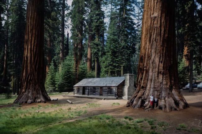
Big Trees Museum (Galen Clarks Cabin), Yosemite National Park, 1969
California’s Yosemite National Park. Sierra National Forest borders it on the southeast and Stanislaus National Forest on the northwest. The NPS manages 759,620 acres (1,187 sq mi; 3,074 km2) in four counties, centered in Tuolumne and Mariposa and extending north and east to Mono and south to Madera.
Cathedral Spires, Yosemite National Park, 1969
Since 1984, Yosemite has been a World Heritage Site for its granite cliffs, waterfalls, clear streams, enormous sequoia groves, lakes, mountains, meadows, glaciers, and biological variety. Just under 95% of the park is wilderness. One of Sierra Nevada’s largest and least fragmented habitats is Yosemite.
Deer and Giant Sequoias, Yosemite National Park, 1969
Granite and fragments of older rock dominate its geology. The Sierra Nevada was elevated and tilted 10 million years ago, steepening stream and river bottoms and creating deep, narrow gorges. Higher elevation glaciers formed one million years ago. They cut and molded Yosemite Valley’s U form downhill.
Firefall, Yosemite National Park, 1969
Forest Path, Yosemite National Park, 1969
Hall Dome from Foot Bridge, Yosemite National Park, 1969
Hall Dome from Glacier Point, Yosemite National Park, 1969
Hall Dome from Glacier Point, Yosemite National Park, 1969
High Country from Washburn Point, Yosemite National Park, 1969
Jeffrey Dome, Yosemite National Park, 1969
Mariposa Grove, Yosemite National Park, 1969
Meadow in Mariposa Grove, Yosemite National Park, 1969
Mirror Lake (Tenaya Creek), Yosemite National Park, 1969
Sunrise over Yosemite Valley, Yosemite National Park, 1969
Superintendent’s Bridge on Merced River, Yosemite National Park, 1969
Upper Yosemite Falls, Yosemite National Park, 1969
Upper Yosemite Falls, Yosemite National Park, 1969
Valley View with Merced River, Yosemite National Park, 1969
Vernal Falls, Yosemite National Park, 1969
Wawona Tunnel Tree, Yosemite National Park, 1969
Wawona Tunnel, Yosemite National Park, 1969
